Košice-okolie District (Okres Kosice-okolie)
Košice–okolie District (okres Košice–okolie; Kassa-vidéki járás) is a district in the Košice Region of eastern Slovakia. It surrounds the city of Košice, which serves as the district seat although it does not belong to the district.
The Košice–okolie district was a part of Great Moravia until the 10th century. After the district fell apart, the area was incorporated into Abaúj and Torna, which were counties of the Kingdom of Hungary.
The region was a part of Abaúj-Torna County from 1882 until the end of World War I. It then became part of the newly formed Czechoslovakia.
Excluding a small section in the north, the district formed a part of Abovsko-turnianská župa of the county of Šariš from 1918 to 1923. From 1923 to 1928, the Košice–okolie district was considered to be a part of Košická župa. From 1923 to 1938, the district was considered to be Slovak land. After the First Vienna Award in 1938, the district was divided between the Kingdom of Hungary and the Slovak Republic, a client state of Nazi Germany. After World War II, the region became known as the district of Košice-vidiek, which is part of Košický kraj. The district of Košice-okolie was established in 1997.
Map - Košice-okolie District (Okres Kosice-okolie)
Map


Country - Slovakia
 |
 |
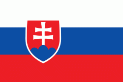
| Flag of Slovakia | |
The Slavs arrived in the territory of present-day Slovakia in the fifth and sixth centuries. In the seventh century, they played a significant role in the creation of Samo's Empire. In the ninth century, they established the Principality of Nitra, which was later conquered by the Principality of Moravia to establish Great Moravia. In the 10th century, after the dissolution of Great Moravia, the territory was integrated into the Principality of Hungary, which then became the Kingdom of Hungary in 1000. In 1241 and 1242, after the Mongol invasion of Europe, much of the territory was destroyed. The area was recovered largely thanks to Béla IV of Hungary, who also settled Germans, leading them to become an important ethnic group in the area, especially in what are today parts of central and eastern Slovakia.
Currency / Language
| ISO | Currency | Symbol | Significant figures |
|---|---|---|---|
| EUR | Euro | € | 2 |
| ISO | Language |
|---|---|
| HU | Hungarian language |
| SK | Slovak language |